

Lot n° 6
Estimation :
400 - 600
EUR
Result with fees
Result
: 708EUR
CHIQUET / PERROT / HENRY... Lot of regional... - Lot 6 - Nouvelle Etude
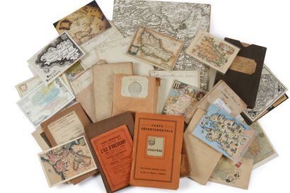
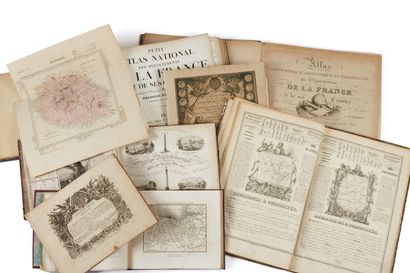
CHIQUET / PERROT / HENRY... Lot of regional and departmental atlases of France 18th and 19th century. 1719 to 1845. The atlases are in-8 or in-4 format. Modern or faded bindings. Not collated. + Puzzle + 13 folding maps of the regions of Brittany, some Cassini maps and modern postcards.
CHIQUET. New François atlas. 1719. In-8, 14 maps. Limits col. Without binding./MICHEL. Departmental atlas. (1835). In-8./PERROT AND ACHIN. A geographical atlas... of the Departments of France. (1845)./PERROT ET ACHIN. Atlas géographique... des Départements de la France. (1830). 1st edition. In sheets./HENRY. New geography... of France. 1835./MONIN. Small national atlas. 1833. In contemporary colours./FIRMIN DIDOT and HACHETTE. Small national atlas of the departments of France. In-8.
Joint: FREMIN and DYONNET. Atlas. 7 maps. Cut out in a game of patience. Paris, ca. 1850. Box in relic state. Missing parts. As is. A set of 7 maps, edited by Logerot, drawn by Fremin, engraved by Ch. Dyonnet. Includes a world map, North America, Africa, South America, Europe, Asia and France. The maps engraved on steel and colored at the time, are glued on wood and cut out to constitute a puzzle.
My orders
Sale information
Sales conditions
Return to catalogue