

Lot n° 11
Estimation :
700 - 1500
EUR
Result with fees
Result
: 902EUR
DUBRENA, V. Hydrographic Chart of France.... - Lot 11 - Nouvelle Etude
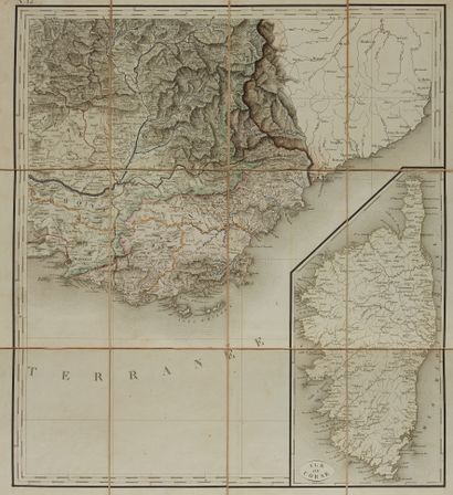
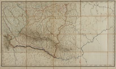
DUBRENA, V. Hydrographic Chart of France. Paris, 1828. Period col. Engraved chart in 12 folded sheets mounted on cloth. Contemporary large vol. in-8, half green basane, long-grained morocco, spine decorated with gilt designs. Map of great freshness, engraved and enhanced with watercolours. Slightly faded slipcase bound with adhesive tape. Old annotations in red ink on several leaves. Ex-Libris Georges Huillet. Each card measures approximately 900 x 820 mm. 250 x 160 mm.
Hydrographic map of France, divided into 21 large basins, with the indication of the navigable and floatable part of each river, as well as the layout of the navigation canals both executed and under construction, drawn up at the Dépôt des Ponts et Chaussées (...). A very fresh map, enhanced with watercolours covering the whole territory and offering a detailed representation of the coasts, rivers and canals. Corrections have been made in red ink on several sheets.
My orders
Sale information
Sales conditions
Return to catalogue