
Lot n° 145
Estimation :
100 - 200
EUR
Result with fees
Result
: 322EUR
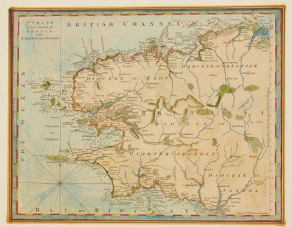
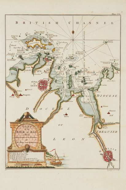
JEFFERYS, Thomas. 7.th Chart of the Coast of France / 9.Char - Lot 145
JEFFERYS, Thomas. 7.th Chart of the Coast of France / 9.Charte / The harbour of St. Malo / Plan of the city of Nantes / Chart of the Road of Bas… Londres, 1762. Noir et blanc. 4 cartes coloriées. 242 x 306 mm.
Cinq cartes + 7 autres cartes par Jefferys : St-Malo, Lorient, Brest, Belle-Île… Importante collaboration avec William Faden : « Maritime ports of France ».
Trois cartes pour les côtes bretonnes mais aussi de nombreux plans de ports ainsi que
Belle-
Isle. Par la suite, Faden publia le Petit Neptune en supprimant le nom de Jefferys tout en signaFade1793.
Joint : Merian. Tabula…Biscaiae. + 2 petites car
§ Exemplaire reproduit dans C. Gaudillat, Anciennes Cartes Marines de la Bretagne 1580-1800, Pl. N°62, 63, 64, 65.
My orders
Sale information
Sales conditions
Return to catalogue