
Lot n° 108
Estimation :
500 - 1000
EUR
Result with fees
Result
: 580EUR
VAN KEULEN, J. New Nautical Chart for the... - Lot 108 - Nouvelle Etude
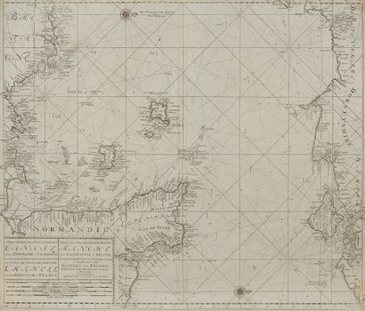
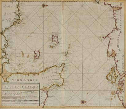
VAN KEULEN, J. New Nautical Chart for the Second Part of the Channel between England and France. Amsterdam, 1698/1709. Col. Nice copy + one copy in black. Cut slightly to the right inside the framing net. 520 x 615 mm.
Map of the English Channel from the atlas of Johannes Van Keulen taken over by his son Gerard. Map N°13. Shows the Cotentin coast, part of the Breton coast up to Trégastel, the Channel Islands. Title in Dutch, French and English. Adorned with 2 wind roses.
Attached a copy in black showing the currents, ca. 1709.
My orders
Sale information
Sales conditions
Return to catalogue