
Lot n° 112
Estimation :
100 - 150
EUR
AA, P. van der. Map of the Government of Brittany according - Lot 112
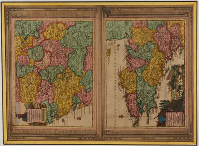
AA, P. van der. Map of the Government of Brittany according to the new Observations. Leiden, 1713. Col. Paper slightly yellowed. Good copy in colour. Size of the sheet : 53 x 40 cm. 230 x 305 mm.
First state. Map of Brittany next to the map of the government of Orleans and surrounded by a border. Decorated with a decorative cartouche in the lower left corner showing a rural scene.
§ Copy reproduced in C. Gaudillat, Cartes anciennes de la Bretagne 1582-1800, pl. N°36 bisssss.
My orders
Sale information
Sales conditions
Return to catalogue