
Lot n° 155
Estimation :
400 - 600
EUR
Result with fees
Result
: 2 125EUR
OGÉE. Geometric Map of the Province of Brittany.... - Lot 155 - Nouvelle Etude
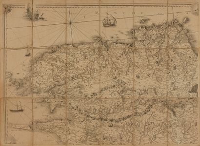
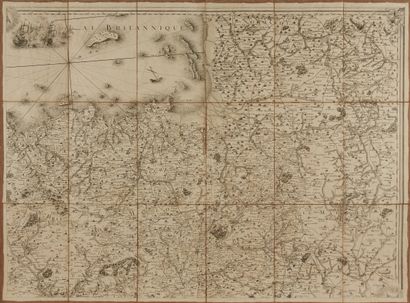
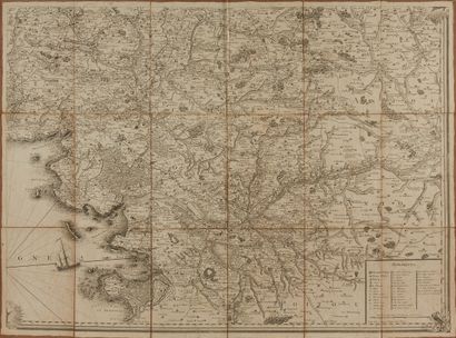
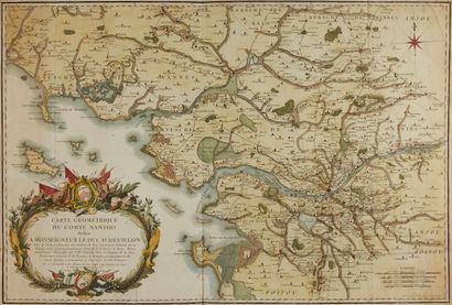
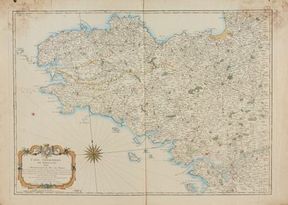
OGÉE. Geometric Map of the Province of Brittany. Ca. 1771. 4 sheets in unattached canvas segments, paper browned. Joint: 2 other maps by Ogée. 1120 x 1550 mm.
Engraved by Nion in 1771, written by C.D. Beauvais and by J. Dezauche. This map is in Nantes by the Author.
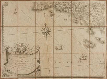
Very important toponymy of the coast and more particularly from "L'Abarevrak" to the Baye d'Audierne". Joint : Ogée. Geometrical map of the Province of Brittany. 1771. 505 x 710 mm. Col. (pl. N°61). + Geometric Map of the County of Nantois. 1768. 590 x 875 mm. Col. Large title cartouche. Rare.
- § Copy reproduced in C. Gaudillat, Cartes anciennes de la Bretagne 1582-1800, Pl. N°60 and 61.
My orders
Sale information
Sales conditions
Return to catalogue