
Lot n° 182
Estimation :
300 - 500
EUR
Result with fees
Result
: 644EUR
VAN KEULEN, Hulst. New correct maritime map... - Lot 182 - Nouvelle Etude
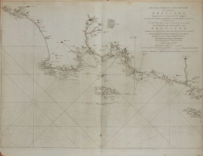
VAN KEULEN, Hulst. New correct maritime map of the coast of Brittany, from the baye d'Hodierne to the isle of Groa... Amsterdam, 1798. Black and white. On fine paper, traces of folds. 585 x 800 mm.
Map showing Hodierne Bay, the Penmark rocks, the Glénan Islands and the island of Groix. Edited by Hulst van Keulen, son of Johannes II Van Keulen. The van Keulen family ran a chart production and publishing business in Amsterdam for almost 200 years. It was founded by Johannes van Keulen, who registered his business as "bookseller and manufacturer of Jacob's sticks".
When Johannes II died in 1770, his widow ran the business in his place, assisted by her two sons, Cornelis Buys (1736-1778) and Gerard Hulst (1733-1801).
My orders
Sale information
Sales conditions
Return to catalogue