
Lot n° 197
Estimation :
3000 - 5000
EUR
- Lot 197
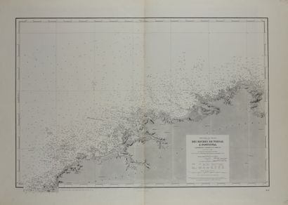
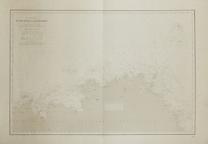
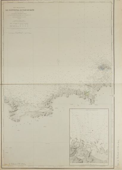
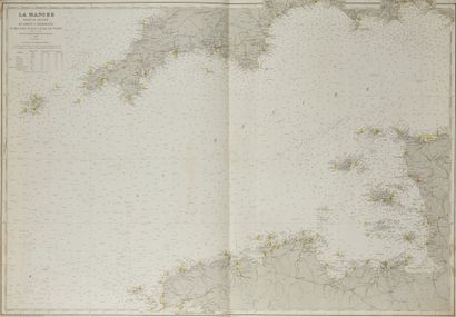
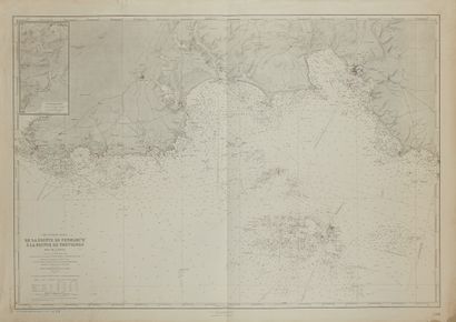
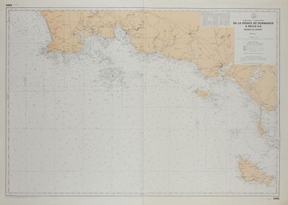
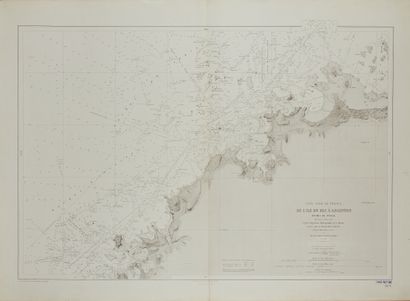
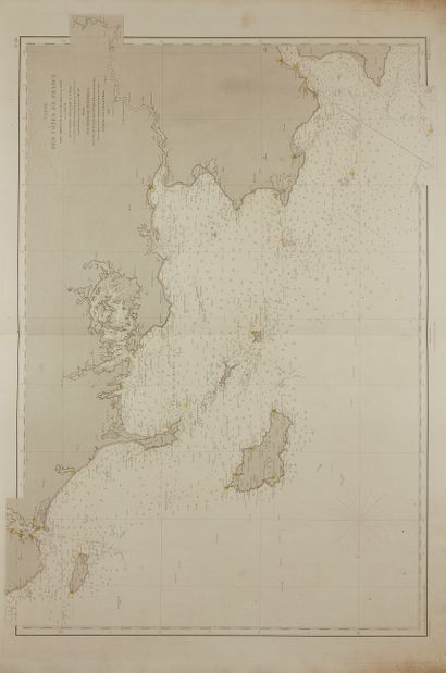
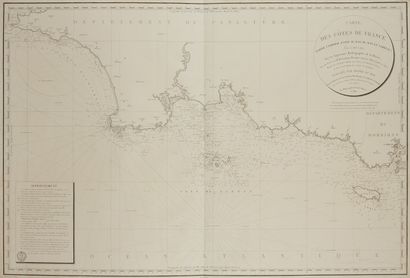
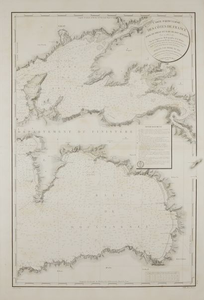
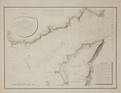
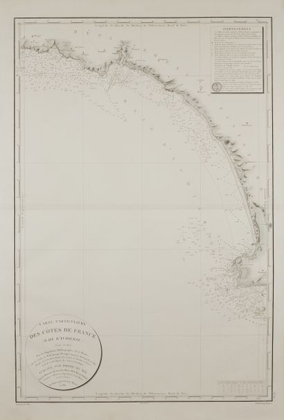
BEAUTEMPS-BEAUPRÉ , C. F. Ensemble de cartes marines des côtes bretonnes (56). Paris, ca. 1844. Black and white. A set of 56 nautical charts. Most of the maps are in folio and broadsheet format, single or double. Some foxing and small tears.
Nautical maps showing the coasts of Brittany, especially the ports, roads, bays and coves; the Probe figures express in feet of France the depths of the water in relation to the lowest observed seas. They are dated, for the most part, between 1816 and 1891, some are later than Beautemps-Beaupré and dated in the 20th century. The complete list can be consulted in the online catalogue. Beautemps-Beaupré is considered the father of modern hydrography. "His cousin Buache, geographer at the Dépôt des cartes et plans de la Marine, introduced Beautemps-Beaupré to hydrography and cartography between 1783 and 1785. He took part in the expedition in search of Lapérouse in 1791 where he made all the charts of the coasts of the countries with the help of the Borda reflection circle and where he laid the foundations of the hydrographic charts of the navy. Between 1799 and 1838, he was in charge of the methodical cartography of the French coastline. His work was published in "Le Pilote Français" in 1844 in 6 folio volumes, testifying to 20 campaigns at sea which included 613 different cartographic works. He was elected member of the Academy of Sciences in 1810 and of the Bureau des Longitudes in 1826."
Geometric map of the provine of Brittany
Particular map of the coasts of France (Brest bay and Douarnenez bay) 1823
Particular map of the coasts of France (Audierne bay) 1821
Map of the coasts of France (part included between the Raz de sein and Lorient) 1824
Map of the coasts of France (part between Groix island and the Pillar) 1868
North coast of France (from the island of bec to Argenton) 1882
From the tip of Penmarch to Belle-Île (color) 1975
From the tip of Penmarch to the tip of Trévignon 1911
La Manche/ western part 1900
From Pontusval to Batz island 1842
From Batz island to Bréhat island 1843
From Porsal rocks to Pontusval 1842
Quad 1603
La francia/Museo Palazzo Vecchio Firenze
Plan of the Brest Narrows 1822
Plan of the port of the island of sein 1817
Map of the port of Audierne 1818
Map of the torch cove (Audierne bay) 1818
Map of the port of Camaret 1816
Map of the black stones road 1822
Particular map of the coasts of France (entrance of the roadstead of Brest and southern part of the channel of the oven) 1822
Particular map of the coasts of France (northern part of the channel of the oven and surroundings of the island of Ouessant) 1822
Particular map of the coasts of France (Belle-Île, Quiberon peninsula, Houât and Haedik islands, Grand Mont coast) 1827
Particular map of the coasts of France (Lorient harbour entrance, Groix island, pouldu cove, entrance of the aven and basse jaune) 1824
Map of Concarneau 1824
Particular map of the coasts of France (Glénan islands, Forest bay, Bénodet cove and part of the Penmarch rocks) 1824
From the tip of Corsen to the Cape of the Goat 1907
Passes and roadstead of Morlaix 1842
Maps of the coasts of France (around Brest) 1823
Particular map of the "chaussée de sein" and the passage of the "raz de sein" 1819
Map of the rocks of Penmarch 1821
Map of the Toulinguet, Petit Leach and Corbeau passages 1816
+
Plan of the surroundings of the cap de la chèvre 1816
Plan of the gully of Brest 1822
Map of the port of conquêt X2 1816
Map of the surroundings of argenton 1818
+
Map of Laberildut 1816
Map of the surroundings of Douarnenez 1817
Particular map of the coasts of France (Audierne bay) 1821
From the coast of Hévignon to Lorient 1824
Map of the entrance of the Odet 1824
Map of the coasts of France (part included between Lorient and saint Nazaire) 1829
From the island of batz to the seven islands 1946
Coasts of France/Rade de Brest 1880
Map of the entrance of the vilaine 1866
Particular map of the coasts of France (part included between pontusval and l'ile de bas) X2 1842
Map of the coasts of France 1843
From Ouessant to the Loire 1872
La Manche/ West part/ from Brest to Cherbourg and from Scilly islands to Isle of Wight 1900
Rade abri de Brest 1913
From the point of Ker Morvan to the island of iock 1934
From Porsal to the St Mathieu coast 1909
From Ushant Island to Penmarch Point (colour) 1975
From Ushant island to Penmarch point - Brest approaches X2 1909
Passes and roadsteads of Lorient and Port-Louis (color) 1940
La manche/Western part/ from Brest to Cherbourg and from Scilly Islands to Isle of Wight 19
My orders
Sale information
Sales conditions
Return to catalogue