
Lot n° 235
Estimation :
150 - 200
EUR
Result with fees
Result
: 193EUR
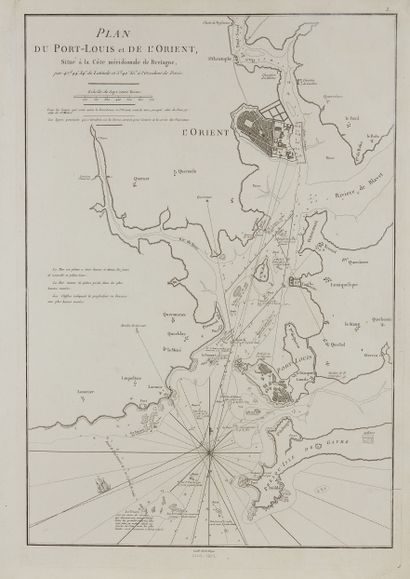
ACCORDING TO DE MANNEVILLETTE. Plan of the Port-Louis de l'O - Lot 235
ACCORDING TO DE MANNEVILLETTE. Plan of the Port-Louis de l'Orient, situated on the southern coast of Brittany. Paris, ca. 1775. Black and white. Faint wetness in the upper right corner. 485 x 335 mm.
Interesting map representing Lorient and Port-Louis, headquarters of the "Compagnie des Indes Orientales", published in the "Neptune Oriental".
My orders
Sale information
Sales conditions
Return to catalogue