
Lot n° 145
Estimation :
100 - 200
EUR
Result with fees
Result
: 322EUR
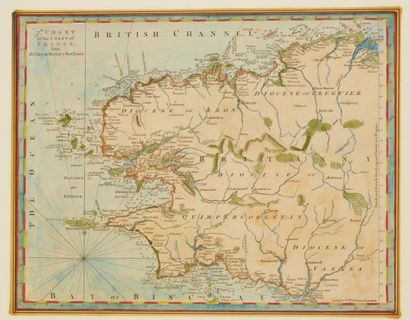
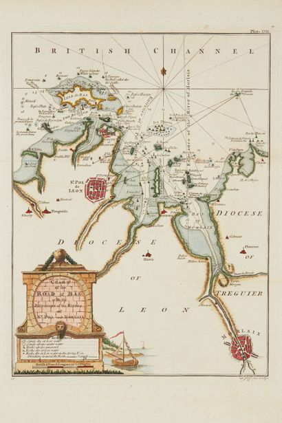
JEFFERYS, Thomas. 7.th Chart of the Coast... - Lot 145 - Nouvelle Etude
JEFFERYS, Thomas. 7.th Chart of the Coast of France / 9.Charter / The harbour of St. Malo / Plan of the city of Nantes / Chart of the Road of Bas... London, 1762. Black and white. 4 coloured maps. 242 x 306 mm.
Five maps + 7 other maps by Jefferys : St-Malo, Lorient, Brest, Belle-Île... Important collaboration with William Faden : " Maritime ports of France ".
Three maps for the Breton coasts but also numerous plans of ports as well as
Belle-
Isle. Thereafter, Faden published the Petit Neptune by deleting the name of Jefferys while signing Fade1793.
Joint: Merian. Tabula...Biscaiae. + 2 small car
Copy reproduced in C. Gaudillat, Anciennes Cartes Marines de la Bretagne 1580-1800, Pl. N°62, 63, 64, 65.
My orders
Sale information
Sales conditions
Return to catalogue